
Integrating OpenStreetMap data into your web pages with OpenLayers
Layer Cake

© Antonina Germanova, 123RF.com
OpenLayers is a JavaScript library that allows you to integrate maps into web pages. You can program the geodetic data directly or read it from a database.
OpenStreetMap [1] is a free project that was founded in 2004 with the goal of creating a freely usable and expandable world map. Contributors gather geodata, load the information into the database, and edit the data. The data includes roads, railways, buildings, and other geographic information. The data from OpenStreetMap finds its way into highway maps, as well as cycling maps, walking maps, and countless special applications.
The geospatial information in OpenStreetMap is freely available, so people can integrate the maps into their own blogs or websites. Even the raw data is freely accessible for development work, including integration with route-finding tools and mobile navigation apps. For instance, you can use OpenStreetMap to display points of interest (POIs), tourist trails, or weather stations (Figure 1). You can also use OpenStreetMap for accessing and displaying land registration data. The only tribute you need to pay to the community is an indication of the source with a reference to OpenStreetMap.
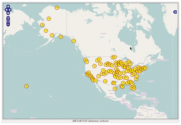 Figure 1: Weather stations in the USA. The geographic locations were taken from a database that lists approximately 20,000 stations.
[...]
Buy this article as PDF
(incl. VAT)
Buy Linux Magazine
Subscribe to our Linux Newsletters
Find Linux and Open Source Jobs
Subscribe to our ADMIN Newsletters
Support Our Work
Linux Magazine content is made possible with support from readers like you. Please consider contributing when you’ve found an article to be beneficial.

News
-
Three Lines of Code Improve Linux Storage Performance
A developer changed three lines of code, giving Linux storage performance a 5% bump.
-
AUR Hit Again with Malicious Packages
Once again the Arch User Repository is plagued by a high volume of malicious packages.
-
Alpine Linux 3.24 Features Fresh Desktops and a Newer Kernel
If you're a fan of Alpine Linux, it's time to upgrade because the latest version has been released with KDE Plasma 6.6, Gnome 50, and Linux kernel 6.18 LTS.
-
EU Open Source Strategy Plays Key Role in Tech Sovereignty Package
Comprehensive measures adopted by the European Commission aim to reduce dependency on non-EU countries.
-
Linux Foundation Report Indicates AI Driving Tech Hiring
Within growing security and skills gaps, AI has been found to be a positive driving force behind tech hiring trends in Europe.
-
United Nations Open Source Portal Goes Live
A new open source portal seeks to coordinate and scale open source efforts across the United Nations system.
-
KDE Linux Drops AUR
KDE Linux developers have dropped the Arch User Repository from the build pipeline due to security concerns; other distributions should consider doing the same.
-
California May Exempt Linux from Its Age-Verification Law
After backlash from the Linux community, California may be backing off on its promise to force all operating systems to verify age, but one platform may still have to comply.
-
Another Logic Bug Found in Linux Kernel
Qualys has discovered a vulnerability in the Linux kernel that can be used to elevate standard user privileges.
-
Ubuntu Core 26 Offers Game-Changing Enterprise Features
Ubuntu Core 26 could be a game-changer for organizations looking for increased security and reliability.